Thermal Imaging Drone Surveys Across Essex
Some problems are invisible until you look at them in infrared. Flown with a DJI Matrice 4T thermal platform, our surveys show where a building is losing heat, where water has got into a flat roof and which solar cells have stopped working — all from the air, with nothing dismantled.
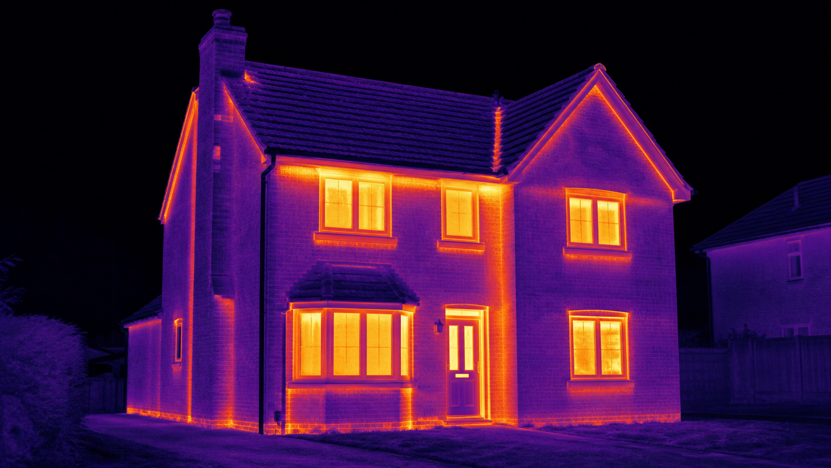
Heat loss mapped
Missing insulation, cold bridging and air leakage shown across the whole envelope.
Damp and ingress
Trapped moisture in flat roofs shows as distinct thermal patches.
Solar and electrical
Failed cells, hot junction boxes and overheating plant identified while running.
Night flights available
Best results come after dark or early morning, and we fly then.
What the survey produces
- Radiometric thermal imagery of each elevation and the roof
- Matching visible-light frames so every anomaly can be located on the building
- Written notes identifying each anomaly and its most likely cause
- Flat-roof moisture mapping where water ingress is suspected
- Solar array scan flagging underperforming or failed cells
- Recommended areas for further investigation, prioritised
How a thermal survey runs
- 1We check the forecast for a suitable temperature difference — cold, dry and still gives the cleanest result.
- 2For heat loss work, we agree an early morning or after-dark slot and ask that heating has been on normally beforehand.
- 3On site we fly each elevation and the roof, capturing thermal and visible frames of the same view.
- 4Anomalies spotted in the live feed get extra close passes so there is no ambiguity later.
- 5You receive the paired imagery and written findings, with anomalies prioritised by likely significance.
How thermal work is priced
Charged at £160 per hour — the higher rate reflects the thermal platform and the analysis that follows the flight. Travel is free within 30 miles of Witham, Essex, then £1.50 per mile.
Domestic thermal survey
£160A house or bungalow: all elevations and the roof scanned for heat loss, insulation gaps and damp, with notes on what each anomaly indicates.
Book thisCommercial survey
£320Larger buildings, flat roofs and multi-unit sites, including moisture mapping and a scan of roof-mounted plant and solar.
Book thisSolar array scan
From £160Infrared inspection of a generating array to find failed cells, diode faults and hot junction boxes without anyone going on the roof.
Book thisThermal survey questions
Certified. Insured. Trusted.
We take safety and compliance seriously. Every flight meets strict UK CAA regulations, fully insured and documented.
CAA Certified Operator
Fully licensed and compliant with UK aviation regulations
£1M Public Liability
Comprehensive insurance for complete peace of mind
GVC Training
Remote Pilot, Certificate of Competence
Live Flight Logs
Transparent operations with full compliance documentation
Independent by design — we survey, we don't sell repairs. No conflict of interest.